HERA mapper
The leading photogrammetry software for professional drone mapping
 CAPTURE
 DIGITIZE
 CONTROL
 MEASURE & INSPECT
 COLLABORATE & SHARE
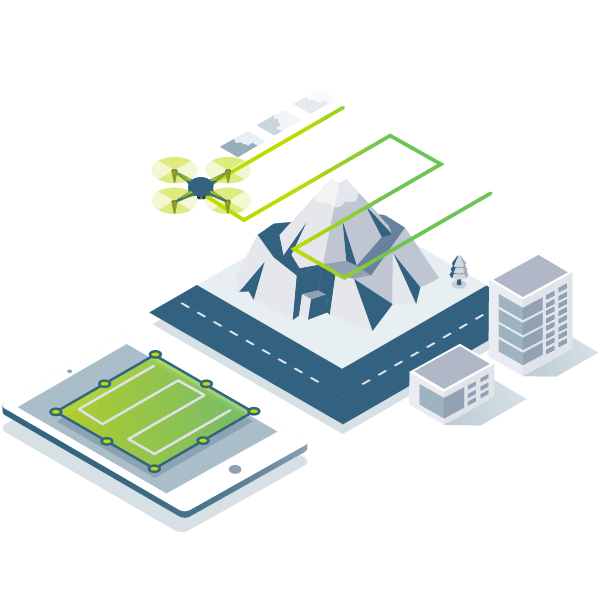


Photogrammetry solution to power applications across industries
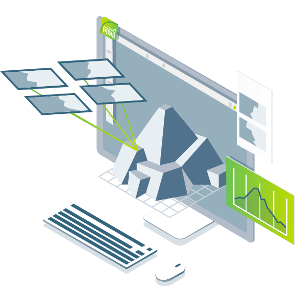
Advanced data processing for precise results

Survey-grade results
Obtain results with sub-centimetre accuracy thanks to photogrammetric analysis. 1-2 pixel GSD in X, Y directions 1-3 pixels GSD in the Z direction

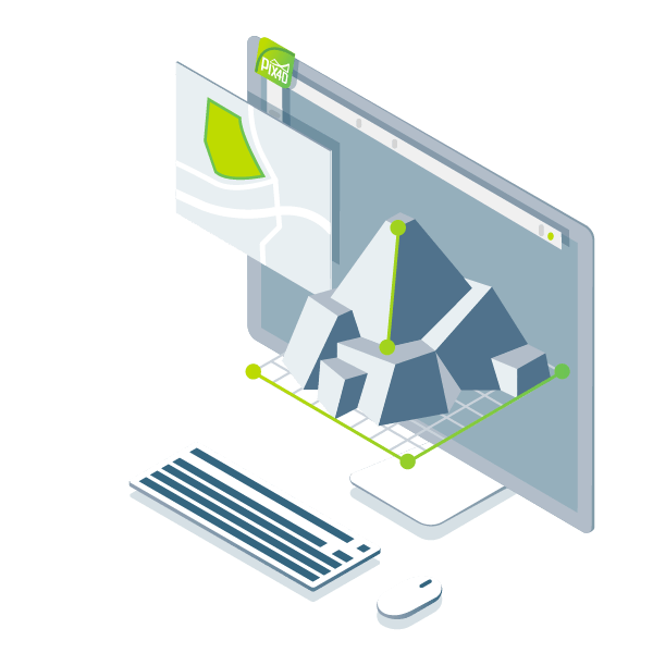
Complete control over your project
Define an area of interest, select processing options, add ground control points or edit point clouds, DSMs, meshes, and orthomosaics.

Your workflow, your choice
Use default templates for automatic processing of your projects, or create your own with custom settings for full control over the data and quality.
The end-to-end photogrammetry tool for every project
Generate high resolution outputs for any project and use case
Easily export your digital maps and models to industry-compatible formats for further analysis or reporting
.las, .laz, .ply, .xyz
GeoTiff (.tif), .kml
GeoTiff (.tif), .xyz, .las, .laz
.ply, .fbx, .dxf, .obj, .pdf
GeoTiff (.tif), .shp
GeoTiff (.tif)
Latest news about photogrammetry and drone mapping
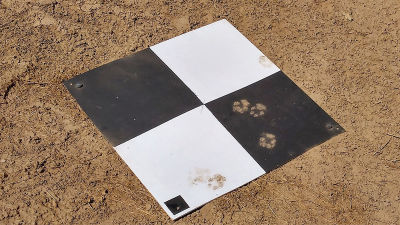
Ground control points: What are they and why are they important?
We discuss what are the ground control points (GCPs), how many are needed for an accurate aerial map, how they affect accuracy and why they look the way they do.
Read more >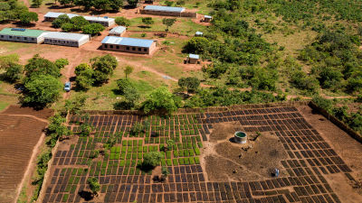
Fighting the climate crisis with drones in rural areas
Wells for Zoe is using PIX4Dmapper to map reforestation projects in Malawi as they replant trees and support the local community with freshwater wells. Find out how!
Read more >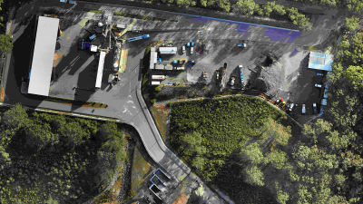
Keeping track of stockpiles with drone mapping
Learn how PIX4Dmapper helps construction companies improve their operational workflows - whether that’s measuring stockpile deposits and withdrawals, or modeling a site itself.
Read more >
HIGH QUALITY POINT CLOUD CAPTURING
No 3D modelling skills are required. The users only need a click and HERA will capture all the data need for the photogrammetry process including geo-tagged photos or precisely GPS logs.
The data is compatible with all photogrammetry software on the market.
ADVANCE POINTCLOUD VISUALIZATION
Cesium cross-platform allow our customers to create and build their own unique map with all the features such as 3D point cloud upload or high-res orthomosaic upload ability as simple as some click. No programming skill are required.
